MHG2189 - Stone Rows, Broughwin
Summary
No summary available.
Type and Period (1)
- STONE ALIGNMENT (Undated)
Protected Status
Full Description
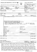
The remains of stone rows lie on low ground to S of Broughwhin, and betw 'Cairn Hanach' (ND 3100 4084) and fence of enclosed park to W of Groat's Loch.
Two rows can be seen, aligned approx NNW and SSE, diverging to N. from a single stone. The W row contains eleven stones and is 111ft long: the eastern row, with four stones is 80ft long and finishes 10ft away from the other row.
The stones, set facing across the rows are '... of the usual character ...' Some 20ft beyond the end of the west row is a single stone, set across the row, which may be associated.
RCAHMS 1911.
There are a small number of stones, a few of them earthfast, in a bog within the area indicated by RCAHMS. They form an irregular line but are a natural formation.
Visted by OS (N K B) 27 April 1967.
(Accepted as an antiquity by Myatt; not natural).
Cairn Hanach (ND34SW 30), also known as Kenny's cairn, lies to W of remains of two rows of small stones. The stones are small and flat, of local sandstone and with their broad faces aligned along the rows. They are situated on level and low-lying ground and run approx in a SSE to NNW direction. The row to W has ten stones over a distance of 34m whilst the second row to the east has three stones over a distance of 24m. None of the stones is more than about 0.4m above the surface.
L Myatt 1988.
Sources/Archives (3)
- --- SHG1694 Text/Publication/Article: Freer and Myatt, R and L J. 1982. 'The multiple stone rows of Caithness and Sutherland. 2. Their description. I', Caithness Fld Club Bulletin Vol. 3 April 1982, p.58-63. Caithness Fld Club Bulletin. 58-63. 60, No. 60.
- --- SHG2664 Text/Report: RCAHMS. 1911. The Royal Commission on the Ancient and Historical Monuments and Constructions of Scotland. Third report and inventory of monuments and constructions in the county of Caithness. . 186-7, No. 572.
- --- SHG3158 Text/Publication/Article: Myatt, L. 1988. The stone rows of northern Scotland. 277-318. 280, 287, 314, No. 6.
Map
Location
| Grid reference | Centred ND 3110 4080 (30m by 30m) (2 map features) |
|---|---|
| Map sheet | ND34SW |
| Civil Parish | WICK |
| Geographical Area | CAITHNESS |
Finds (0)
Related Monuments/Buildings (0)
Related Investigations/Events (0)
External Links (1)
- https://canmore.org.uk/site/9023 (View RCAHMS Canmore entry for this site)
Comments and Feedback
Do you have any more information about this record? Please feel free to comment with information and photographs, or ask any questions, using the "Disqus" tool below. Comments are moderated, and we aim to respond/publish as soon as possible.

